3D Laser Scanning for Upgrade Layout Engineering in Paper Mills
3D laser scanning captures the as-built conditions of an existing WSR subsystem, Material Handling- or Effluent Treatment- Plant in a paper mill
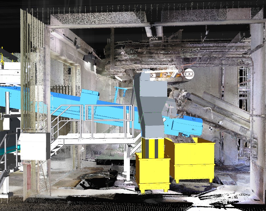
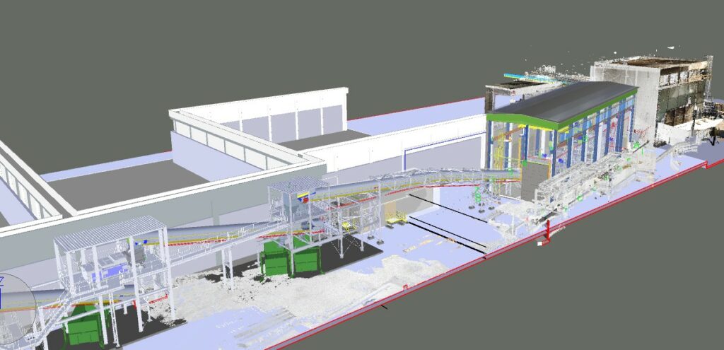
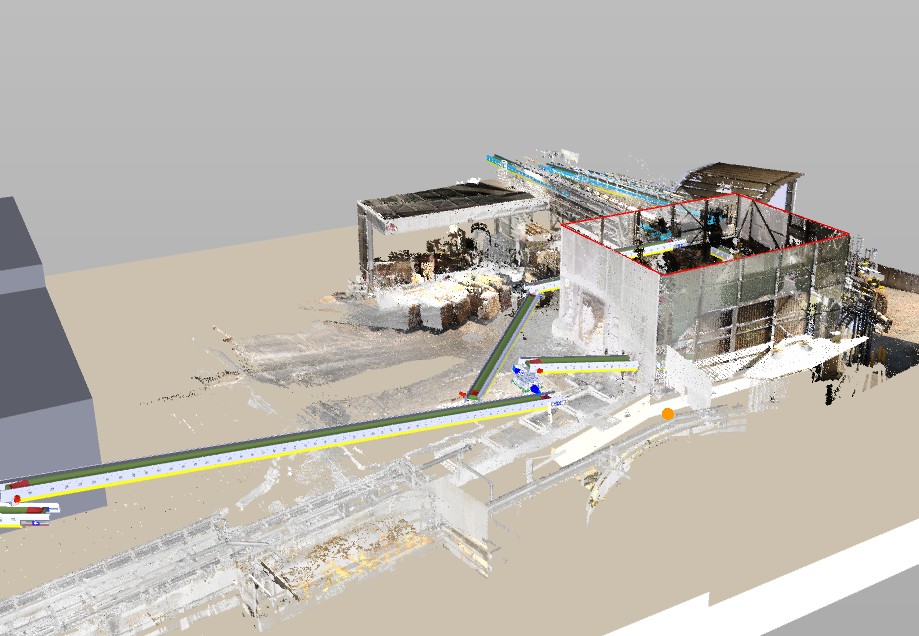
The capturing is executed with millimeter accuracy using Laser and LiDAR scanners, millions of data points are recorded to generate a point cloud model, which is then converted into a 3D environment for engineering use.
Key functionalities
- Accurate As-Built Documentation
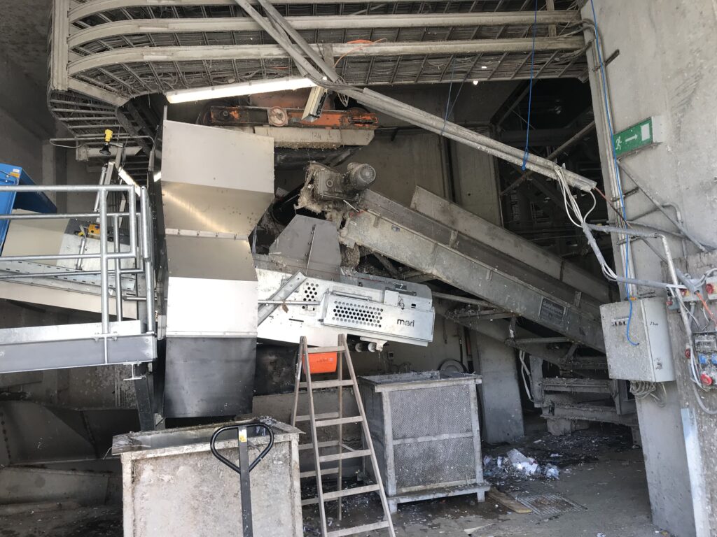
- Captures existing tanks, piping, cable trays, structures, and confined spaces.
- Provides a digital twin of the mill for precise integration of new systems.
- Clash-Free Design for Brownfield Projects
- Engineers overlay new equipment (ETPs, scrubbers, sludge presses) in the scanned 3D model.
- Ensures new piping, cable routing, and foundations fit without site surprises.
- Complex Geometry Capture
- Ideal for irregular structures, congested pipe racks, or legacy areas with no drawings.
- Detects underground or overhead space constraints for routing.
- Remote Collaboration
- The 3D scan allows engineers, operators, and contractors to “walk through” the plant virtually, even from remote locations.
- Lifecycle Utility
- Beyond project execution, the scan becomes part of the digital asset for maintenance, inspection, and future upgrades
Advantages for Environmental Solutions & Upgrades
- High Accuracy → ±2–3 mm precision, far better than manual surveys.
- Full Coverage → Captures areas that are difficult or unsafe to measure manually.
- Rapid Data Collection → Large mill areas can be scanned in hours instead of weeks.
- Reliable Basis for 3D Modeling → Reduces dependency on outdated or missing 2D drawings.
Project Advantages
- Clash Detection Before Construction → Minimizes costly rework during installation.
- Optimized Layouts → Accurate space utilization for new tanks, pipelines, and racks.
- Reduced Downtime → Faster installation due to pre-fabricated piping/cables designed with real as-built dimensions.
- Lower CAPEX & OPEX Risks → Prevents “surprise” site modifications that escalate budgets.
- Safety Improvements → Limits manual site surveys in hazardous or high-access zones.
Typical Scope in Paper Mill Environmental Projects
- Scanning of existing ETP areas, sludge handling plants, pipe racks, utility corridors.
- Capture of congested mill interiors where new pipelines/cables must pass.
- Conversion of point cloud data into intelligent 3D CAD models (Invetor and NAVIS works)
- Integration of new system components and meri machines into the model.
- Clash analysis and layout optimization for:
- Piping systems (effluent, sludge, utilities).
- Cable trays and MCC connections.
- Structural modifications (platforms, supports, racks).
Typical Deliverables
- Point Cloud Database – raw and processed.
- As-Built 3D Model – showing all captured structures, piping, and equipment.
- 2D Extraction from 3D Scan –
- Updated GA drawings.
- Isometrics with exact dimensions.
- Cable routing layouts.
- Civil/structural interface drawings.
- Clash Reports – between existing and proposed systems.
- Digital Twin (Optional) – fully navigable model for operations & maintenance.